They fled to the attic. Huib’s father ventured down to the ground floor, which had filled like a bathtub, to raid the pantry for provisions. A few days later, soldiers arrived in dinghies to help the de Vriends evacuate to their local church, which was built on the village’s highest ground; not long after, they were moved by rail to a town 10 miles away, where Huib attended kindergarten for several weeks before his family was allowed to return home. “Only later did I realize that my grandmother belonged to the generations with an inbred fear of water,” he says. “She never even learned to swim. It was not normal to swim. So you can imagine that even a meter of water was enough to make them nervous.”
The de Vriends survived, but more than 1,800 of their compatriots did not. Three hundred thousand Dutch were left homeless, and one-tenth of the nation’s farmland flooded. The famously pragmatic Queen Juliana, who had banned her subjects from bowing and curtseying to her, pulled on rubber boots to join the relief effort. “God,” she declared, “now calls upon our powers of resilience.”
In the Netherlands, that resilience ultimately meant far more than a season or two of furious rebuilding. De Vriend grew up to become a coastal and fluvial morphologist, a kind of scientist that studies the dynamics of shores and rivers. Though he insists the floodwaters did not set his career path, he acknowledges that “you don’t forget something like that.” (He also learned to swim.) He meanwhile became part of a growing army of engineers, designers, and scientists who since 1953 have made it their life’s mission to work with water, as the Netherlands built itself into the world’s premier laboratory for how to tame the rivers and the seas. Today, the country’s ideas and expertise may be its most valuable export. “Retreat is not an option, though we know it’s dangerous. The only option is to protect ourselves,” says Free University of Amsterdam professor Jeroen Aerts, the world’s foremost expert in flood-risk management. “If we invest right now in innovative measures, we can avoid a lot of damage in the future.”
Visitors who come to the Netherlands in the hopes of seeing a foolproof system of flood control that they can easily duplicate back in their home countries are bound to be disappointed. The Dutch have learned the hard way that no single solution will suffice. Their rebuilding efforts since 1953 have evolved away from post-disaster clichés–We’ll show the storm who’s boss!–to something far more sophisticated. What you see there now, especially what has been built in the past few years, is indeed the architecture of the future, as the fight against rising tides goes global. But it’s also the attitude of the future. The Dutch have lately been working with nature instead of battling it, lowering barriers against the water instead of raising them. They’re harnessing the power of the cloud–enormous amounts of data and cutting-edge computer modeling–to predict the consequences of the clouds. They’re building seawalls so beautiful you wouldn’t recognize them. And as I discovered, the most important lessons they are trying to impart might not be about dikes and dunes at all.
Nearly half of the world’s population lives within 60 miles of the sea, and hundreds of millions more reside in river valleys. In Hong Kong and Singapore, New York and Shanghai, thousands of acres of new waterfront land have been created through the magic buildup of landfill–and then stacked with luxury condos and gleaming office towers. Yet the risk of coastal living has grown in lockstep with that land’s soaring value. Seas are rising. And land is sinking. The soil under Jakarta, Indonesia, for instance, drained steadily of groundwater, is collapsing 4 inches a year.
As scientists predict a wetter, stormier future for much of the planet, the Dutch have become a nationwide consulting company, fanning across the world to talk about water. They are working on water-related projects from the Mississippi to the Mekong, and their thinking was a cornerstone of New York’s $20 billion post–Hurricane Sandy protection plan. “We are branding this knowledge around the globe, and we are benefiting from it,” says Piet Dircke, who is widely known as the “water guru” at the Amsterdam-based engineering-and-consulting firm Arcadis. “You don’t need too many Dutch,” he says, “but a few can help you a little bit!” Dircke is a jovial evangelist for better water management, who speaks of dikes with a passion usually reserved for football teams and refers to New Orleans’s revamped levees as “absolutely fabulous!” He spends about 200 days a year away from home, and his recent itinerary reflects the demand for Dutch help: Bangkok, Jakarta, Ho Chi Minh City, Dhaka, Shanghai, New York, New Orleans, Los Angeles, San Francisco.
When Dircke started at Arcadis 20 years ago, it was mainly a Dutch company–“95% of our business was Dutch,” he says. Last year, just 12% of the firm’s $3.35 billion in revenue came from the Netherlands; the U.S. was by far its largest market. Arcadis is working with the Army Corps of Engineers on wetlands rejuvenation in the Mississippi Delta. It is helping to restore the Los Angeles River’s natural flow. And it did hydrological-modeling work for the Bloomberg administration on Jamaica Bay in New York, hoping it will lead to more post-Sandy flood-protection business. “If I were a New Yorker, I would be very excited,” he says. “How fantastically interesting!”
And for the Dutch, how fantastically lucrative. It’s undeniable, says Matthijs van Ledden, an executive at the engineering firm Royal HaskoningDHV, that the surge in Dutch business is closely related to the surge of global disasters. After Katrina, van Ledden moved to New Orleans for four years to lead a team that helped the Army Corps strengthen the city’s levees. Governments fund most of the water business, but lately, Royal HaskoningDHV has seen strong growth in corporate spending, too. In Thailand the 2011 floods crippled factories of multinationals like Honda and Canon, stalling their supply chains. Today, they’re devising their own risk-reduction plans. “They could wait for the government,” van Ledden says. But in many locations they are choosing to move forward independently, and as fast as possible.
While these Dutch companies are competitors, they also collaborate. Arcadis, Royal HaskoningDHV, and a third major Dutch contractor, Boskalis, won business in Louisiana after teaming up with the Dutch government on a post-Katrina plan that offered the Army Corps ideas for rebuilding. They did the same for New York after Sandy last year. All three companies also belong to a research consortium that is testing new flood-protection solutions in the Netherlands. Meanwhile, five smaller engineering and design firms have banded to form an export-focused group called Dutch Water Design, which now has projects in Belgium, Brazil, and India.
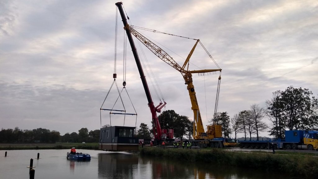
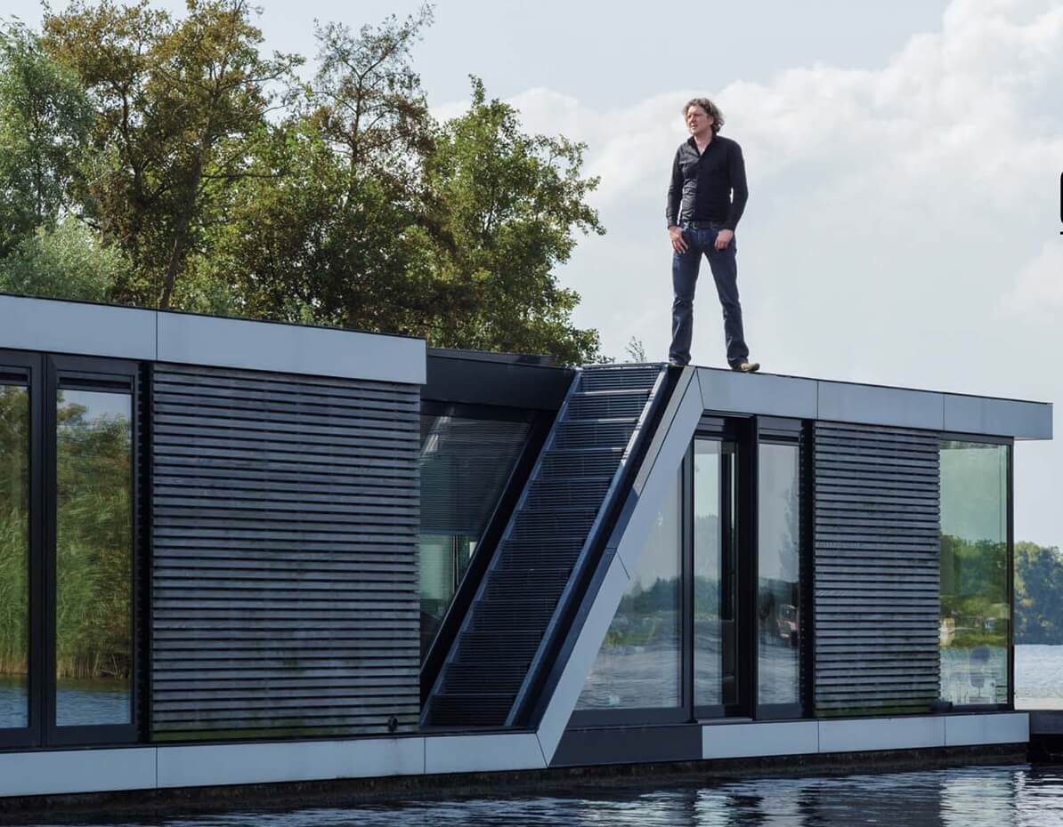
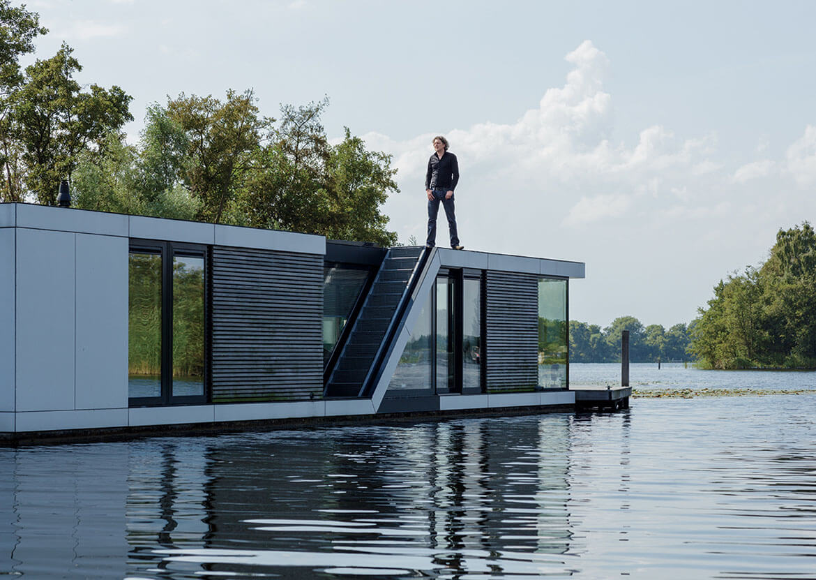
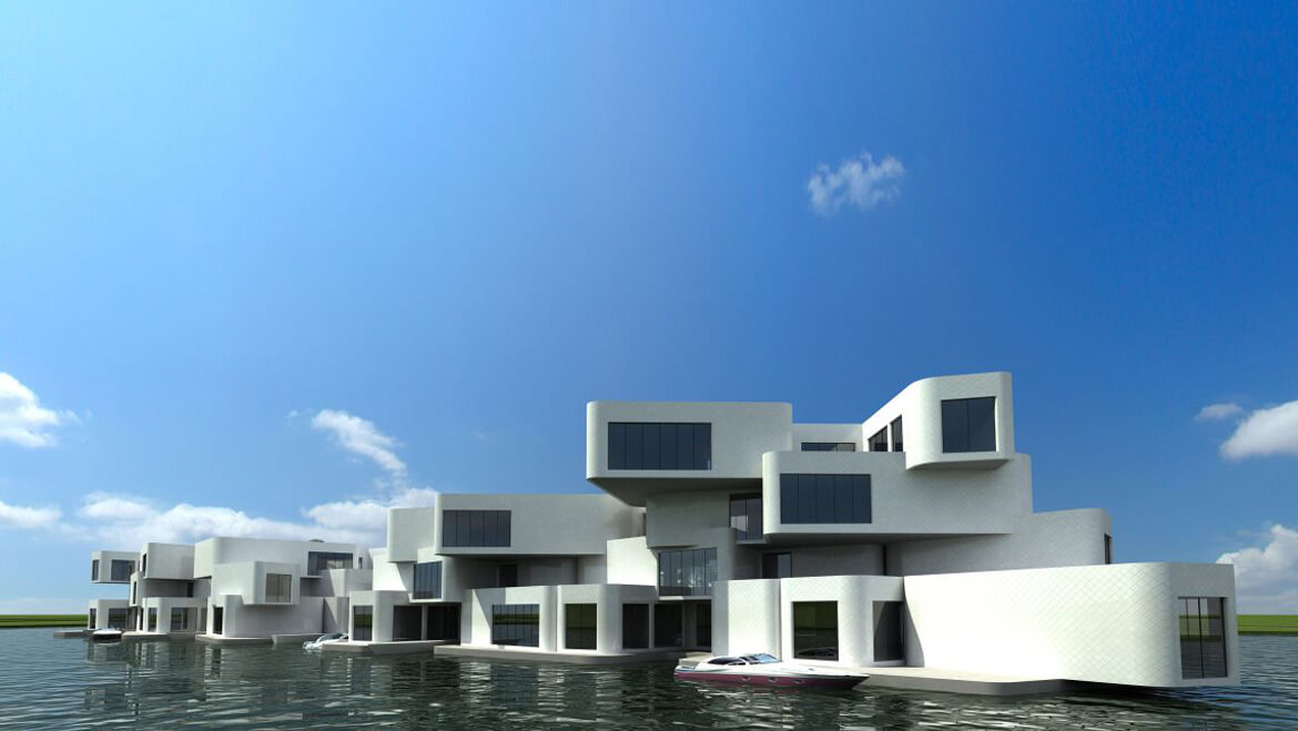
Dutch ambitions go well beyond retrofitting. Architect Koen Olthuis’s atelier, Waterstudio.nl, does only water-based projects and has designed several floating houses in the Netherlands. Now, in the Maldives, he–in partnership with the developer Dutch Docklands–is building a resort, complete with an 18-hole golf course, that will float entirely on a Styrofoam-and-concrete foundation. He sees it as an early step into a wholly new market; eventually, he’d like to build floating housing for the poor in the Maldives and Bangladesh. “Building on water gives so much more freedom than land,” Olthuis says. “The next step is not going higher into the air, like 50 or 100 years ago. It’s going over the water.”
Such futuristic talk may reinforce the Netherlands’s reputation as a magical nation of water whisperers, a notion that van Ledden finds laughable. When he lived in New Orleans, he says, some people spoke to him as if he were some sort of Dutch saint. “People look at you as if, when you touch something, everything will become dry. But we need to be honest. It took us about 10 centuries to come to the conclusion that we needed to develop a long-term strategy, because short-term measures did not work.” Indeed, his homeland suffered gravely to get all this expertise–and all this business.
here are 16 million Dutch crammed onto a piece of waterlogged land that, if it were part of the U.S., would be one of the smallest states. “Everyone sees the Netherlands as a place with people who know how to deal with all this,” says Taco Kuijers, a designer at the urban-design firm Posad. “But we’re not geniuses. We’ve just learned a lot from our mistakes. And we’ve learned slowly.”
If you praise the Dutch for being “ahead” in flood protection, you must also acknowledge that they have been “ahead” in waterborne woe. They’ve been losing lives to floods long before the 20th century–the killed as many as 10,000 people and destroyed hundreds of thousands of homes. Perversely, St. Elizabeth is the patron saint of widows, dying children, and the homeless.
Still, it was the 1953 flood–a Netherlandish Katrina–that truly mobilized the country. It inspired unprecedented investment in a massive, multidecade project, known as the Deltaworks, to fortify the coast. Traditional dike-building materials–clay, sand, fear–were replaced by steel, concrete, and confidence in modern engineering. Rotterdam got a new guardian angel, the Maeslantkering, which looks like a giant drawbridge toppled sideways into the water. Thousands of tourists visit each year to marvel at its wings–gates, each as wide as the Eiffel Tower is tall, that swing shut to protect Europe’s largest port. The Deltaworks effort also led to the 5.6-mile-long, $3.5 billion Oosterscheldekering, completed in 1986, which forms the world’s largest storm-surge barrier. A monument at one end captures the Dutch sense of conquest-by-construction: hier gaan over het tij de maan de wind en wij–“Here the tide is ruled by the wind, the moon, and us.”
Huib de Vriend, as an academic at the think tank Delft Hydraulics, built models predicting how water would flow through and past the Oosterscheldekering. He also tracked how the barrier disrupted the flow of sand needed to replenish tidal shoals and beaches that naturally help to slow waves and soften storms. He says, in professor-speak, that the shoals “evolved negatively” because of the Oosterscheldekering. In laymen’s terms, they shrank because they didn’t get enough sand.
Dutch law compels the government to maintain the coastline at 1990 levels. This is politically sensible and ecologically stupid–a waterfront home may seem permanent, but shorelines shift. This strategy, which keeps the beach a half-mile wide in places, requires a costly annual deposit of 1 million cubic meters of sand. Which compelled a group of scientists including de Vriend and his Delft colleague Marcel Stive to solve an interesting puzzle: Can nature be harnessed to help do this unnatural thing?
Two years ago, the Sand Engine was born. Twenty million cubic meters of sand were mounded to form a half-mile-wide, 1.25-mile-long beach extension. Hydrologists and engineers had calculated that currents would eventually move 60% of the sand northward, 40% south. “Look what happens if you build a sand castle at the edge of the surf and the tide comes in,” says Stive. “You see the wave diffuse around it. The sand is not gone. It just spreads in all directions. If a sand castle disappears in half an hour, the Sand Engine is supposed to last 20 years.”
The Sand Engine, which is shaped roughly like a stiletto stepping onto the existing shoreline, does mostly what its designers expected: It buffers a vulnerable coast while delivering recreational and ecological benefits. The lagoon created by the “heel” has become a popular kite-surfing venue as well as an important habitat for juvenile flatfish. Flocks of gulls loll on the sand. Sea grass has taken root, dotting the white expanse with green. The sand has traveled roughly according to plan. Already, local governments in France and England have initiated projects mimicking the Dutch design.
This might be premature: The Sand Engine team also expects surprises. “All models are built with inputs, a system, and outputs. But what if you don’t know how the inputs will vary?” says de Vriend, who is now 66. Usually he has a gentle, grandfatherly mien and thinks for a few beats before speaking. But as we stand on an escarpment carved by the waves since his last visit to the Sand Engine, he seems like a giddy 4-year-old. “Isn’t this fantastic?” he tells me. “The dynamics are always changing, and it’s very challenging to understand. Models are never more than what we already know.”
Six miles north of the Sand Engine sits the district of Scheveningen, which has two distinct stretches of seafront. The northern section is chockablock with cheap souvenir stands and neon-lit bars. On the southern stretch, the sky feels bigger. Construction crews here are finishing a new, $100 million promenade that’s all bright and clean, bleached wood and powder-blue steel, as if the scene had been run through an Instagram filter called “New Dutch.”
There was no dike here before–it was one of the coast’s least-protected sections–and only the most knowing observer would notice the one there now. The rest of us would see an undulating waterfront park, sloping seaward from the dunes to a one-way street for cars, then to a bike path, then to a pedestrian area and beach. The largest project of architect Age Fluitman’s career, it is an artful demonstration of how to integrate traditional beachside amenities with sophisticated protections against future storms. “Making a dike here was quite extreme. You want something 10 or 12 meters high, and 30 meters wide–a big thing!” says Fluitman as we stroll the promenade. Dressed in a half-buttoned check shirt, cargo shorts, and flip-flops, he looks more like a beachgoer than a boardwalk builder. Originally, he explains, the government hired Spanish architect Manuel de Solà-Morales, who was renowned for rejuvenating Barcelona’s waterfront. Fluitman worked with Solà-Morales and took over after his boss died last year.
Building a multilayered dike hidden under a beachfront is not easy. Regulators decreed that no single object on this dike, which is designed to withstand a storm even stronger than the one in 1953, could weigh more than 700 kilograms; anything heavier could puncture the seawall mid-storm. Fluitman, lanky and athletic, lopes over to a pedestrian bridge linking the dike-top roadway with the pedestrian promenade. “It looks like steel, right? But it’s actually built of composites,” he says, beckoning me to join him underneath the bridge. Crouching, he points out the small nuts and bolts studding the ends of the beams, explaining that they’re calibrated to detach in a major storm surge. “This bridge can support 500 people. But what other bridge in the world is designed to fall apart into hundreds of pieces?” At one point during the planning process, he adds, one local official asked, “Can’t we plant some palm trees?” In response, Fluitman designed 36-foot-tall lampposts crowned with arms reaching in different directions–stylized palm trees. He smiles. “These fall apart too.”
Fluitman seems especially pleased by the contours of his promenade. He came to this beach as a boy and recalls it as straight and flat; given the chance to redesign it as an adult (he’s 36), he created horizontal and vertical curves to increase visual drama. “See these gentle hills?” Fluitman says. “This makes you interested: What’s over there? What’s beyond that bend?” He discovered that Dutch regulators didn’t want a different beach. They rejected the curved proposal, arguing that straighter beaches make stronger barriers. But Fluitman asked for evidence. He suggested that rather than rely on conventional wisdom, they do some new modeling. And in the end, he was right: A curvy coast dissipates wave forces in a way that a straight seawall cannot.
The Dutch love data. Fluitman got his curves because of it. And a Dutch sense of caution has compelled everyone working in the field of flood control to collect and analyze immense amounts of it to make a watertight case. The government has mapped by air, to astonishing detail with laser and radar, the entirety of the nation’s topography. That information has inspired one of the most promising–and exportable–new innovations: 3Di, a cloud-based system that can simulate the effects of a rainstorm or a levee breach, storm surge or a water-main break. “The Netherlands is very conservative. We think we can solve everything with a bit of sand,” says Jan-Maarten Verbree, who heads IT at Nelen & Schuurmans, the water-focused consultancy behind 3Di. “But we say that with a bit of IT, you can increase safety even more.”
The computer system is based on the work of a professor at the Technical University of Delft. Wytze Schuurmans, Nelen & Schuurmans’s principal, says 3Di is 1,000 times faster–and can be accurate “more or less to the inch”–than any conventional flood models currently in use. In the Nelen & Schuurmans lab, a Spartan collection of desks located in a house in the medieval heart of Utrecht, Verbree and his colleague Olga Pleumeekers hover over an on-screen projection of the city of Delft. Pleumeekers decides to dump nearly 4 inches of rain on Delft in just one hour, “just to see.” This is not realistic, she tells me. “It’s a lot of water.”
She zooms in on a neighborhood between a key canal and Delft’s Cathedral. Within minutes, the floodwaters reveal the town’s topography–though the canal has spilled its banks, some canal-side streets remain dry while roads further inland are awash. Within three hours, water laps at the Cathedral’s apse, and as Pleumeekers zooms out for a regional view, a spreading quilt of blue reveals the extent of the storm. Any sane person would want to flee, but not northward–the model shows that the A4, the main artery to Amsterdam, is now underwater too.
The goal here goes beyond disaster planning for the Netherlands; the firm hopes to build a web-based version of 3Di that would allow a Manhattan building manager to simulate, say, a hurricane’s effect on his apartment tower. What 3Di most resembles is an aqua-centric version of SimCity–“but with realistic data and calculations,” says Verbree. When Pleumeekers switches to a machine holding data for Long Island–less detailed than what it has for the Netherlands, but sufficient to do basic simulations–I can see the potential.
What should we do, she asks? “Make it rain,” I reply. We center a cloud over an area on the edge of New York that was hard-hit by Superstorm Sandy and unleash 2.5 inches of rain. Within two hours, widening blue ribbons streak across the area. After five, the water has drained from the higher ground. Even after a day, low-lying coastal areas are still wet.
If you were to choose a person who best represents how Dutch thinking about water management has evolved over the past two decades, it might not be an engineer or architect at all. In fact, it might be Tracy Metz, who was appointed in 2007 to a national task force convened to propose ideas for the next 50 years of flood preparedness. Metz was, in her own words, “a representative of the people.” She was a journalist, with a typical awareness of the importance of water in the country’s past as well as in its policy making–an awareness reinforced by the 200-to-300-euro-per-person levy that every resident pays for local flood protection. But beyond her own story–born in Los Angeles, she moved to the Netherlands in the 1980s and jokes about growing up in a place with too little water, only to end up in one with too much–she says she was no water expert.
Over time, she became one. She learned that the dream of Holland as watertight fortress–canals are moats, straighter rivers are safer rivers, higher walls are better walls–is compelling but flawed. She discovered that the materials deployed in the Deltaworks, the country’s coastal bulwark, were sophisticated, but the methodology was essentially “the way they’ve done it from the Middle Ages.” Last year, she wrote Sweet & Salt: Water and the Dutch, the seminal book on Dutch water management. One of the book’s lessons is how Metz’s own education coincided with a shift in the official Dutch mind-set: They now accept that Mother Nature may be hard to tame but she seems willing to partner. “We used to defend against the water as our enemy,” Metz says. “You could say that there’s a new attitude: Water as our frenemy.”
This attitude has become as crucial to the Dutch as their technical sophistication–if not more so. And once again, floods helped bring about the change. In 1993 and 1995, as Deltaworks finally neared completion, floods hit the Dutch from behind. The Rhine, Meuse, and Waal rivers swelled with Alpine snowmelt, forcing 250,000 people from their homes. The decision was made to strengthen river defenses, but this time in a different way. For centuries, the Dutch had tried to channel rivers and streams into ever-narrower courses and canals. But gradually they came to realize that river systems were akin to greyhounds; you can try to confine them to small spaces, but they will always need room to run.
Hence, Room for the River, an initiative with 34 interconnected projects, including, most ambitiously, the digging of a new 2.5-mile channel in the city of Nijmegen that will alleviate the pressure at a particularly tricky bend in the river and create an island from what was a peninsula. In some places, dikes will be bolstered and raised. In others, they’ll be lowered, a radical, even heretical notion in a land where dikes have been piled ever higher for more than a millennium.
The largest dike to be lowered will be in the Noordwaard, an area in the southwestern Netherlands. For the past century, this area has been polder–wetland turned into fertile fields. Within the next two years, a 1.5-mile stretch of a 25-foot-tall dike will be lowered by 10 feet, creating new spillways for the New Merwede River. Nearly 8 square miles of fields once planted with potatoes and wheat will be “depolderized,” with large portions of the land flooding during times of high water.
Dikes are relatively easy to deconstruct. But entire livelihoods–especially those of a people who have, for centuries, clawed dry land from sea and swamp–are tougher. “This is a national safety project. But even with national aims, we have had to deal with personal interests,” says Hans Brouwer, a senior river expert with Rijkswaterstaat, the federal agency for flood protection. Fifteen farms were condemned, along with low-lying homes that will be threatened by the new spillways. “There were 75 families living in the Noordwaard. Forty will stay. It has been difficult. It has been painful.”
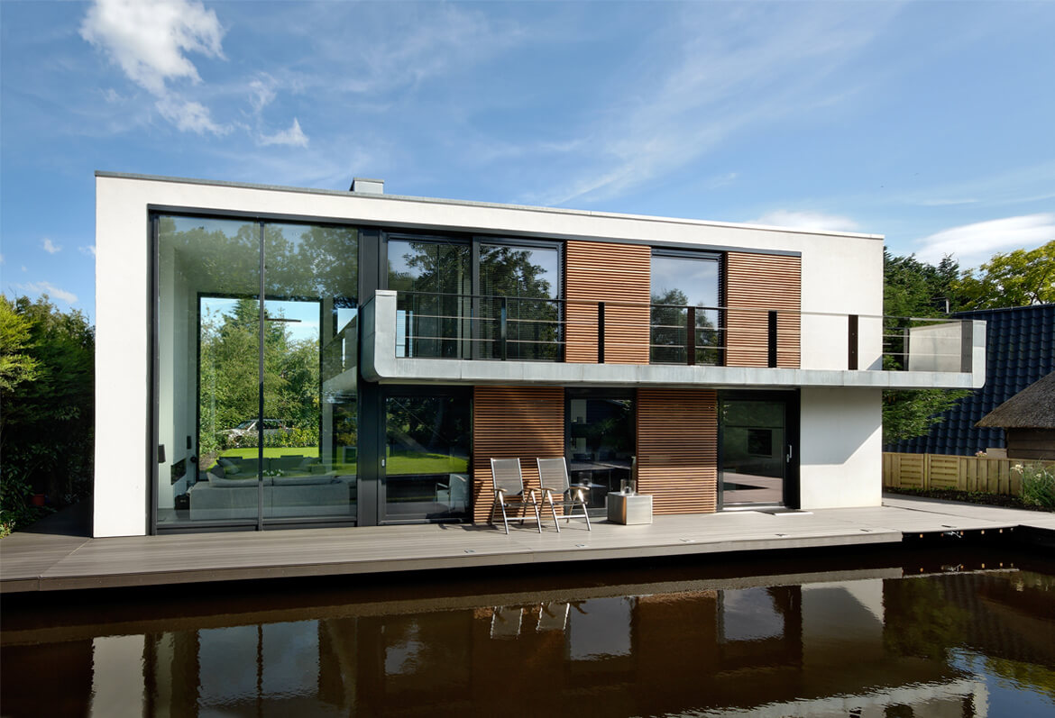
The government has done little to buy influence, refusing to pay above market for condemned properties. But neither has it deployed eminent domain. Vic Gremmer, a social worker who moved to the Noordwaard “to stay in nature,” says his payoff and the building subsidies offered by the authorities didn’t cover the costs of his new land and construction of his new house, down the road and up a small but significant rise from the old one. “We lived there for 21 years,” he says as we sip coffee in his new kitchen. He gazes out at his new patio and the new reed-edged canal beyond that. “We’ve got this new house, and these beautiful sights. But the old house, we were used to it–the keys go here, that goes there. Our children were born there.”
Perhaps the most innovative element of Room for the River is how officials built relationships with those whom the program will displace. Room for the River has project managers whose main job is to talk with residents. One whom I met was formerly a political lobbyist at EU headquarters in Brussels. He calls his current work “lobbying at the kitchen-table level.” The long-term approach in the Noordwaard has relied heavily on humility; officials repeatedly struck various compromises to help win residents’ support–or at least acquiescence. And slowly, through these conversations–15 years and counting–the officials helped Gremmer and most of his neighbors to understand the science behind the project as well as the necessity.
An effort like the depolderization–and more broadly, Room for the River–“is not only about engineering and design and technical innovation. It’s also about collaboration, a regional approach, and a mind-set,” says Henk Ovink, a former director-general at the Dutch Ministry of Infrastructure and the Environment, who has been exported to Washington, D.C., to serve as special adviser to Shaun Donovan, secretary of housing and urban development. “You can’t build a levee with a mind-set–you need money, you need ideas, and you need innovation. At the same time, you will never build those things if the mind-set isn’t right.”
Gremmer says there’s much to like about his new home. It sits 13 feet above sea level, so it’s unquestionably safer. He’s an avid birdwatcher, and a variety of species have been arriving in greater numbers. And if he’s hungry for fish, he just slides open the big glass doors to his patio and casts his line. The canal out back teems with eel, carp, and his favorite, snoekbaars–pike-perch. “Filet it,” he says. “Put it in a pan with a little bit of lemon, salt, pepper, butter. Delicious.”
“Are you happy here?” I ask.
He sighs a little before replying: “We’re not there yet.”
Click here to read the article
Click here for the website

